
A Comprehensive Guide to Essential Conservation Software Tools
From tracking endangered species in real-time to analyzing vast datasets that inform policy decisions, conservation technology is revolutionizing how we protect our planet's biodiversity. But with so many tools available, navigating this landscape can be overwhelming. Whether you're a seasoned conservationist or new to the field, understanding the wide array of software tools at your disposal is crucial for making informed decisions that drive impactful change. In this article, we'll explore a comprehensive list of conservation-focused software, categorized by their functions, to help you find the right tools for your specific needs.
Conservation Software Categories
- Wildlife Monitoring and Protection
- Biodiversity and Ecological Monitoring
- Data Management and Analysis
- Citizen Science and Public Engagement
- Remote Sensing and GIS Tools
- Species Identification and Taxonomy
- Marine and Freshwater Conservation
- Habitat Restoration and Management
- Conservation Planning and Management
- Climate Change and Carbon Management
- Invasive Species Management
- Education and Outreach
- Legal and Policy Support
Conservation Technology Software Solutions
This list comprehensive covers a broad range of software used in wildlife conservation technology, ecological monitoring, data management, and more.
1. Wildlife Monitoring and Protection
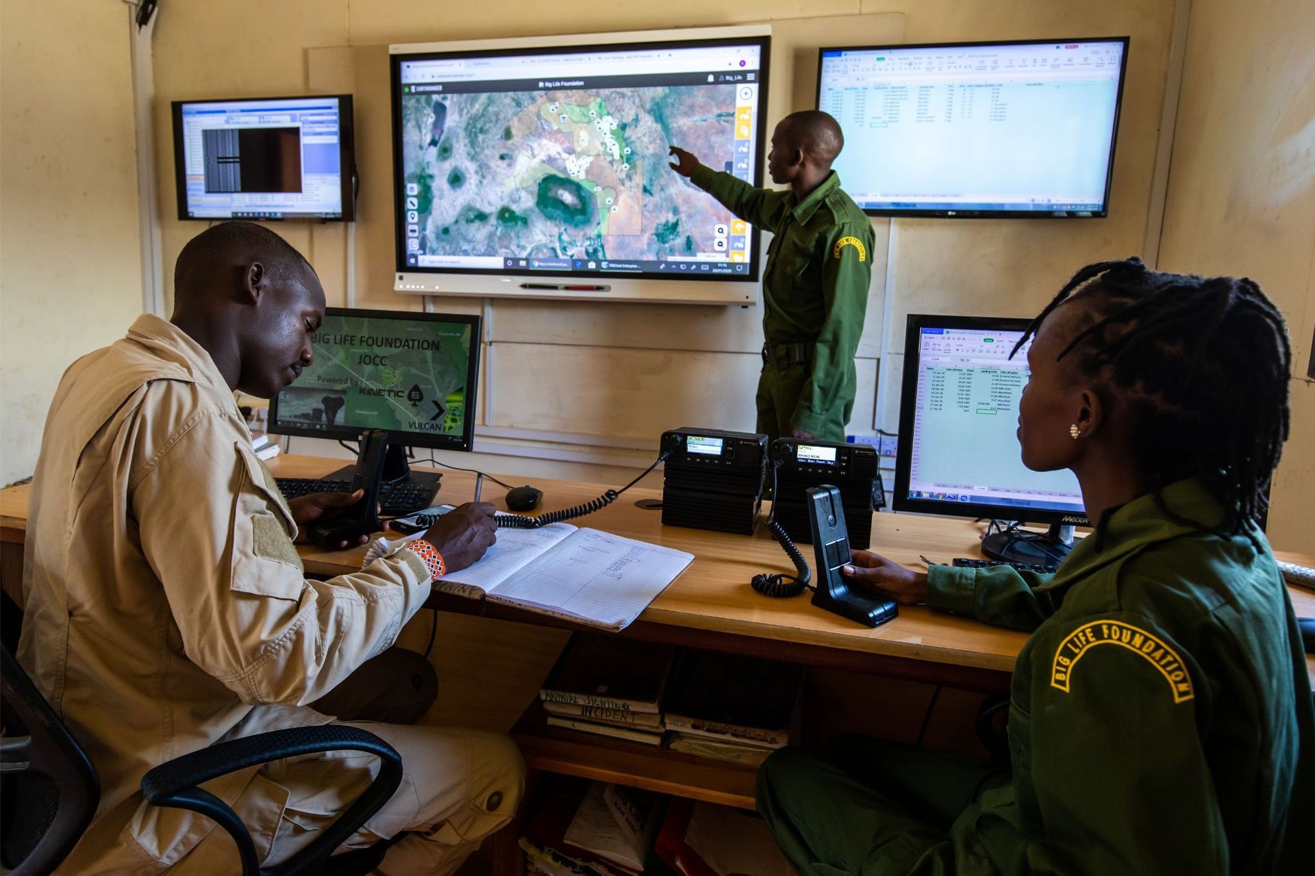
- EarthRanger: A data visualization and analysis software platform that integrates real-time information from wildlife, rangers, and other sources to support protected area management.
- SMART (Spatial Monitoring and Reporting Tool): An open-source software suite that enables protected area managers to collect, analyze, and report on patrol data to improve enforcement and wildlife protection.
- PAWS (Protection Assistant for Wildlife Security): An AI-based tool that uses predictive analytics to prevent poaching by optimizing ranger patrol routes.
- Wildbook: A platform that uses computer vision and machine learning to identify individual animals from photos, aiding in population studies and conservation efforts.
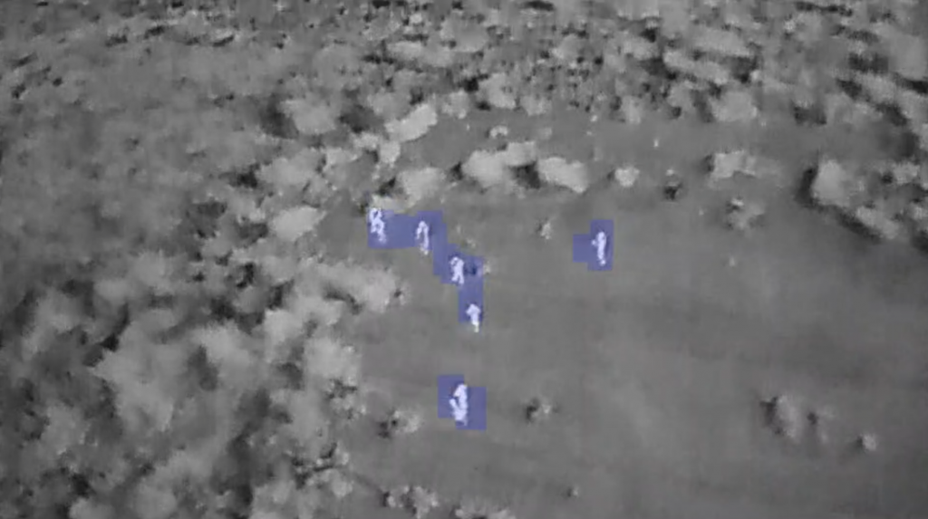
- TrailGuard AI: An AI-powered camera trap system that helps detect and prevent poaching in real-time.
2. Biodiversity and Ecological Monitoring
- iNaturalist: A citizen science platform where users can record and share observations of biodiversity, helping scientists monitor species distribution.
- eBird: A global bird monitoring project where birders submit data on bird sightings, contributing to avian research and conservation efforts.
- BioCollect: A platform for managing biodiversity, ecological, and citizen science data collection projects, with tools for data entry, mapping, and analysis.
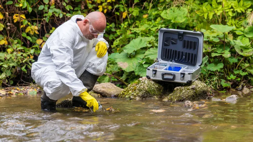
- eDNA (Environmental DNA): A range of software tools like OBITools, VSEARCH, and Kraken for analyzing eDNA samples to detect species presence in environmental samples.
- CameraBase: A database management software for organizing and analyzing camera trap data.
- CyberTracker: Conservation software for mobile data capture and visualization, helping to develop a Worldwide Environmental Monitoring Network.
3. Data Management and Analysis
- Global Biodiversity Information Facility (GBIF): A platform that provides open access to data about all types of life on Earth, supporting conservation and biodiversity research.
- TERRASTORIES: A geospatial storytelling tool that allows communities to map and protect their cultural and ecological knowledge.
- Conservation Evidence: A database of evidence that helps conservationists understand what works, what doesn't, and why.
- MapServer: An open-source platform for publishing spatial data and interactive mapping applications on the web.
- QGIS (Quantum GIS): An open-source Geographic Information System (GIS) that supports viewing, editing, and analyzing geospatial data, commonly used in conservation.
4. Citizen Science and Public Engagement
- Zooniverse: A citizen science platform that enables volunteers to contribute to real scientific research projects, including wildlife monitoring and conservation.
- eMammal: A citizen science project that uses camera traps to engage the public in monitoring wildlife.
- Nature's Notebook: A platform that allows citizen scientists to contribute phenology data, helping scientists track changes in the timing of biological events.
- Project Noah: A tool that harnesses the power of citizen scientists to document wildlife and contribute to global research efforts.
- FrogID: A citizen science initiative that allows users to record frog calls, helping scientists monitor and conserve frog populations.
5. Remote Sensing and GIS Tools
- Google Earth Engine: A cloud-based platform that provides access to satellite imagery and geospatial analysis tools, widely used for monitoring land use, deforestation, and habitat changes.
- Global Forest Watch: A platform that provides near real-time data and tools for monitoring forests, including alerts for illegal deforestation activities.
- LandsatLook Viewer: A tool that allows users to browse and analyze Landsat satellite images for environmental monitoring.
- Sentinel Hub: A cloud-based platform that provides access to Sentinel satellite data for various environmental and conservation applications.
- GEO BON (Group on Earth Observations Biodiversity Observation Network): A global initiative that integrates remote sensing data with in-situ observations to monitor biodiversity.
6. Species Identification and Taxonomy
- IdentifyLife: A platform for the identification and classification of species, using interactive keys and other identification tools.
- GBIF Species API: A service that allows users to query species occurrence records, taxonomic details, and other biodiversity-related information from the GBIF database.
- FishBase: A comprehensive database of information about fish species, including taxonomy, distribution, and ecology.
- Pl@ntNet: A citizen science project and mobile app that helps users identify plant species using images.
7. Marine and Freshwater Conservation
- Marine Protected Areas (MPAtlas): A global map and database of marine protected areas (MPAs) that provides information on their size, management, and effectiveness.
- OpenChannels: An online resource that provides news, tools, and networking opportunities for professionals involved in ocean planning and management.
- Seasketch: A collaborative mapping platform that supports marine spatial planning, allowing stakeholders to design and evaluate management plans.
- Oceanscape Network: A platform that connects marine scientists, conservationists, and the public to share data and insights on ocean ecosystems.
- ReefBase: A global database of information on coral reefs, including data on coral bleaching, fisheries, and management practices.
8. Habitat Restoration and Management
- LandPKS (Land Potential Knowledge System): A mobile app that helps land managers and farmers assess land potential, soil health, and restoration opportunities.
- Restoration Opportunities Optimization Tool (ROOT): A tool that helps identify the best locations for ecosystem restoration projects to maximize environmental and socio-economic benefits.
- Collect Earth: A tool developed by the FAO that enables data collection and analysis for land use, land use change, and forestry (LULUCF) projects.
- Biodiverse: A tool that supports the analysis of biodiversity data, including species distributions, endemism, and evolutionary diversity.
9. Conservation Planning and Management
- Marxan: A conservation planning software used to identify priority areas for conservation based on species distribution, habitat, and other ecological factors.
- Zonation: A software tool that helps conservation planners prioritize areas for biodiversity conservation based on species and habitat data.
- Miradi: A project management tool that helps conservation practitioners design, manage, and monitor conservation projects based on the Open Standards for the Practice of Conservation.
- Conservation Standards Software (CS Tools): A suite of tools for planning and managing conservation projects, designed to support the application of the Conservation Standards.
10. Climate Change and Carbon Management
- REDD+ Decision Support Toolbox: A suite of tools that supports the planning and implementation of REDD+ (Reducing Emissions from Deforestation and Forest Degradation) projects.
- CAIT (Climate Data Explorer): A platform that provides access to global climate data, including emissions, mitigation, and vulnerability assessments.
- CO2calc: A tool that allows users to calculate carbon sequestration and emissions for various land management practices, supporting climate-smart agriculture and forestry.
- CarbonMap: A mapping tool that helps land managers identify areas with high carbon storage potential, aiding in the design of conservation and restoration projects.
11. Invasive Species Management
- EDDMapS (Early Detection & Distribution Mapping System): A tool that allows users to report and track invasive species sightings, helping to coordinate management efforts.
- AquaMaps: A predictive distribution model for marine species, including invasive species, that helps identify areas at risk of invasion.
- CABI Invasive Species Compendium: A database of information on invasive species, including their distribution, impacts, and management strategies.
12. Education and Outreach
- NatureWatch: A citizen science platform that engages the public in monitoring wildlife and ecosystems, with tools for data entry, mapping, and reporting.
- Eco-Schools: A global program that provides tools and resources for schools to engage students in environmental education and conservation activities.
- WWF Together: An interactive app that educates users about wildlife conservation and allows them to explore and contribute to WWF's conservation efforts.
- Roots & Shoots: A program that provides resources and tools for young people to engage in community-based conservation projects.
13. Legal and Policy Support
- Environmental Systems Research Institute (ESRI): Provides GIS and mapping software that supports environmental policy and conservation planning.
- UNEP-WCMC (UN Environment Programme World Conservation Monitoring Centre): Offers a range of tools and databases for biodiversity and conservation policy, including the World Database on Protected Areas (WDPA).
- CITES Trade Database: A database that provides information on the international trade of species listed under the Convention on International Trade in Endangered Species of Wild Fauna and Flora (CITES).
- LawAtlas: A policy surveillance tool that tracks and maps laws and regulations related to environmental conservation and public health.
Conservation technology offers a diverse range of software solutions tailored to various aspects of environmental protection and biodiversity monitoring. By leveraging these tools, conservationists can enhance their efforts to safeguard ecosystems, manage wildlife populations, and engage communities in meaningful ways. As we've seen, each software serves a unique purpose, from real-time wildlife monitoring to climate change mitigation.
The key is understanding how these
nature tech tools can complement your conservation goals and strategies. As the challenges facing our planet continue to grow, so too must our ability to innovate and adapt. By integrating the right technologies, we can empower ourselves to make a tangible difference in the fight to preserve our natural world.
Share this article
Quicklinks


DIGITAL | IMPACT
GET IN TOUCH
zanza@zanza-africa.com
STAY CONNECTED
Sign up for updates